Welcome
1. Introduction
GPS Air Navigator is a moving-map application for VFR (Visual Flight Rules) air navigation, built for pilots who need reliable maps, airspace and aeronautical data on their Android device.
- Real-time moving map with GPS position, North-Up or Track-Up orientation
- Offline maps and aeronautical data, downloadable by country
- Route planning with multiple legs and flight profile
- Airspace proximity awareness and alerts
- GRAMET route weather profile
- Position Report and MAYDAY emergency function
- Automatic and manual flight Logbook
Get Ready to Fly
2. Downloading Maps & Data
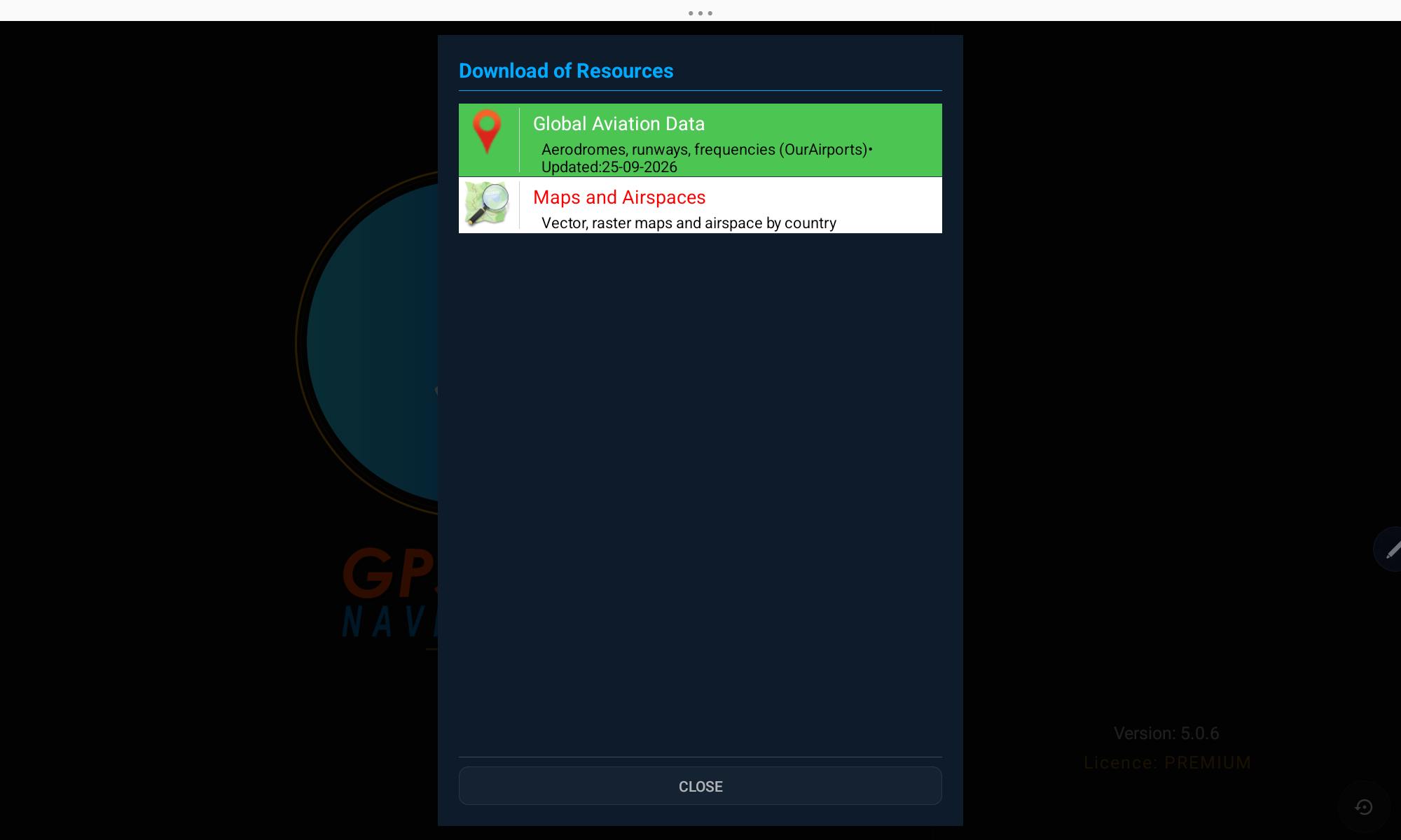
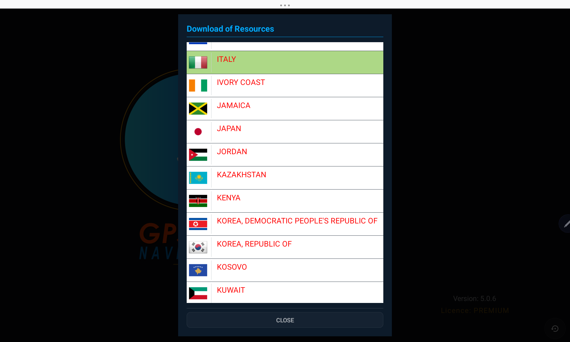
Before your first flight, download the aeronautical data and maps for the country (or countries) where you will fly. Everything is then available offline.
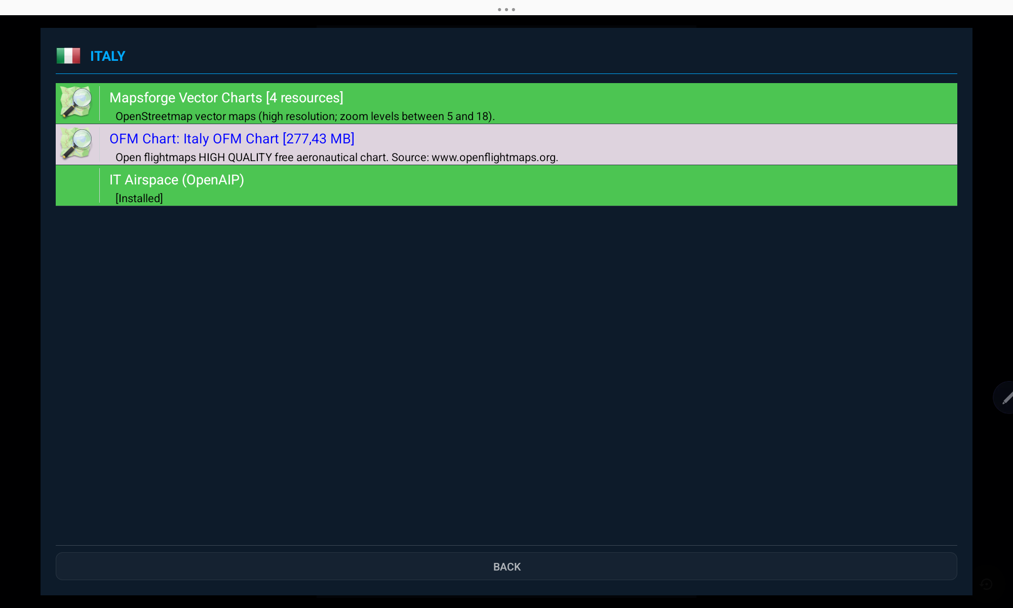
Available chart types
- Mapsforge Vector Chart — free, high-resolution OpenStreetMap-based vector maps (zoom 5–18)
- OFM Chart — high-quality free aeronautical charts by OpenFlightMaps
- WAC Chart — official World Aeronautical Charts published by national authorities
- OpenAIP Airspace — airspace boundaries and classes for the selected country
- FLYERMaps Chart — premium high-quality VFR charts (paid)
Unlock the Full App
3. License & Subscription
GPS Air Navigator can be tried for free, then unlocked with an annual subscription or a one-time lifetime license.
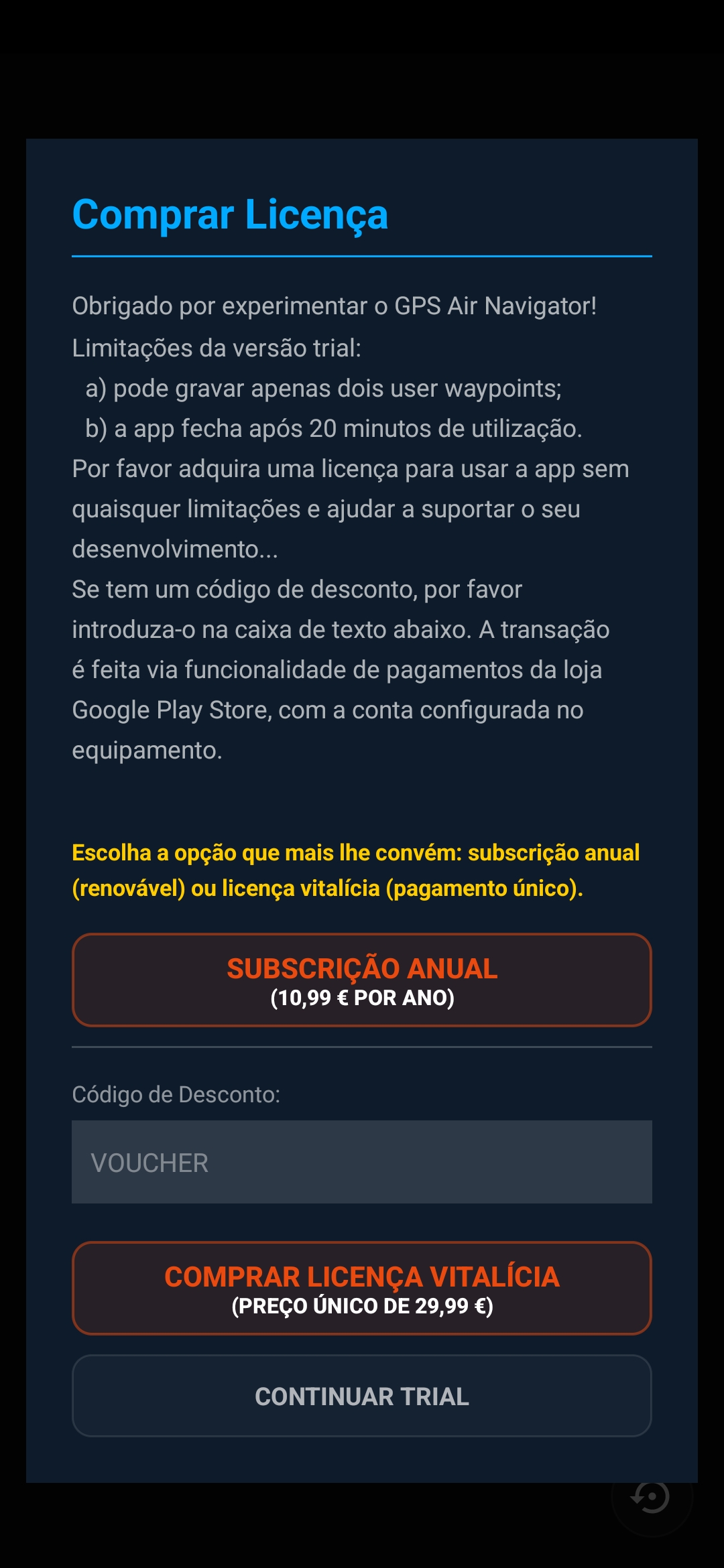
- Trial — limited to 2 saved user waypoints and 20 minutes of use per session
- Annual subscription — full access, renews every year
- Lifetime license — one single payment, full access forever
- Have a discount code? Enter it in the voucher field before purchasing
Payments are processed securely through the Google Play Store, using the account configured on your device.
Two Layouts
4. The Main Screen
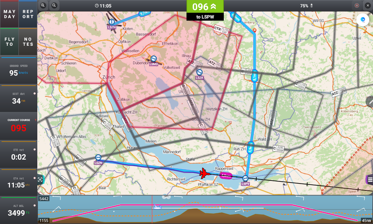
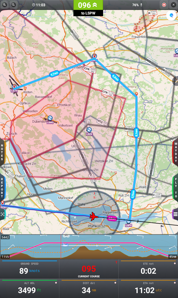
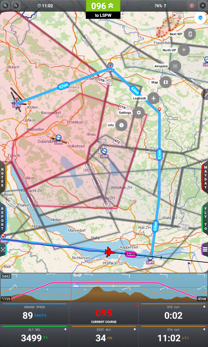
The app adapts automatically to the orientation of your device. In landscape mode, the four main buttons are arranged along the left and right edges; in portrait mode, the same buttons are stacked on the sides of the screen.
On the Map
5. Map Objects
A few symbols appear consistently over the map:
 | Plane — your current position; moves in real time while GPS is available. Color and shape can be changed in Settings. |
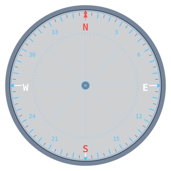 | Compass — rotating compass ring around the plane; can be toggled in Settings or the Layers panel. |
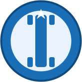 | System Waypoint (white) — part of the built-in database. |
 | User Waypoint (yellow) — created or edited by you. |
Tapping any waypoint opens its info card with Direct To, + Route, Edit/Suggest and, for user waypoints, Delete.
Flight Data at a Glance
6. Flight Data & Buttons
The data panel (bottom of screen in portrait, left side in landscape) shows the six most important numbers for your flight:
- GROUND SPEED — current speed over the ground
- CURRENT COURSE — the track you are actually flying
- DIST — distance to the next waypoint and to the destination
- ETE / ETA — tap to switch between Estimated Time Enroute and Estimated Time of Arrival (UTC)
- ALT MSL — GPS altitude; tap to switch between MSL and QFE
The six main buttons
 CENTER
 LAYERS
- MAYDAY — triggers the flight emergency procedure
- REPORT — opens the Position Report window
- FLY TO — sets a new destination
- NOTES — quick handwritten notes (QNH, frequencies, wind…)
- CENTER — toggles whether the plane stays centered on the map (On) or the map stays fixed while the plane moves across it (Off)
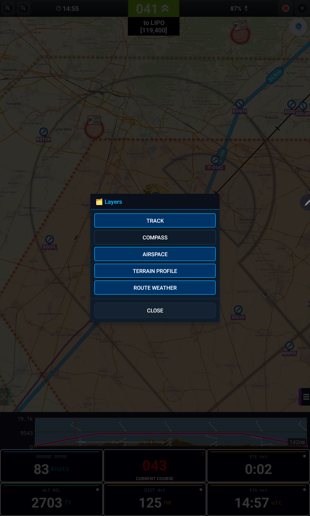
- LAYERS — opens the Layers panel to toggle Track, Compass, Airspace, Terrain Profile and Route Weather (see Map Layers)
Top-bar icons
Tap the round icon on the top-right corner to reveal the labels: Next WP, North UP, Airspace, Map, Logbook, Settings and Info — each opens the matching screen described further below.
Terrain / GRAMET summary strip

A summarized terrain and weather profile is always shown at the bottom of the map, along the current route, so you can compare your planned altitude with the terrain and wind ahead at a glance. Tap this strip to open the full, detailed GRAMET view — see GRAMET Weather Profile.
Where To
7. Waypoints & Fly To
There are two ways to reach a waypoint: tap it directly on the map, or search for it with FLY TO → Waypoints. Either way opens the same waypoint info card.
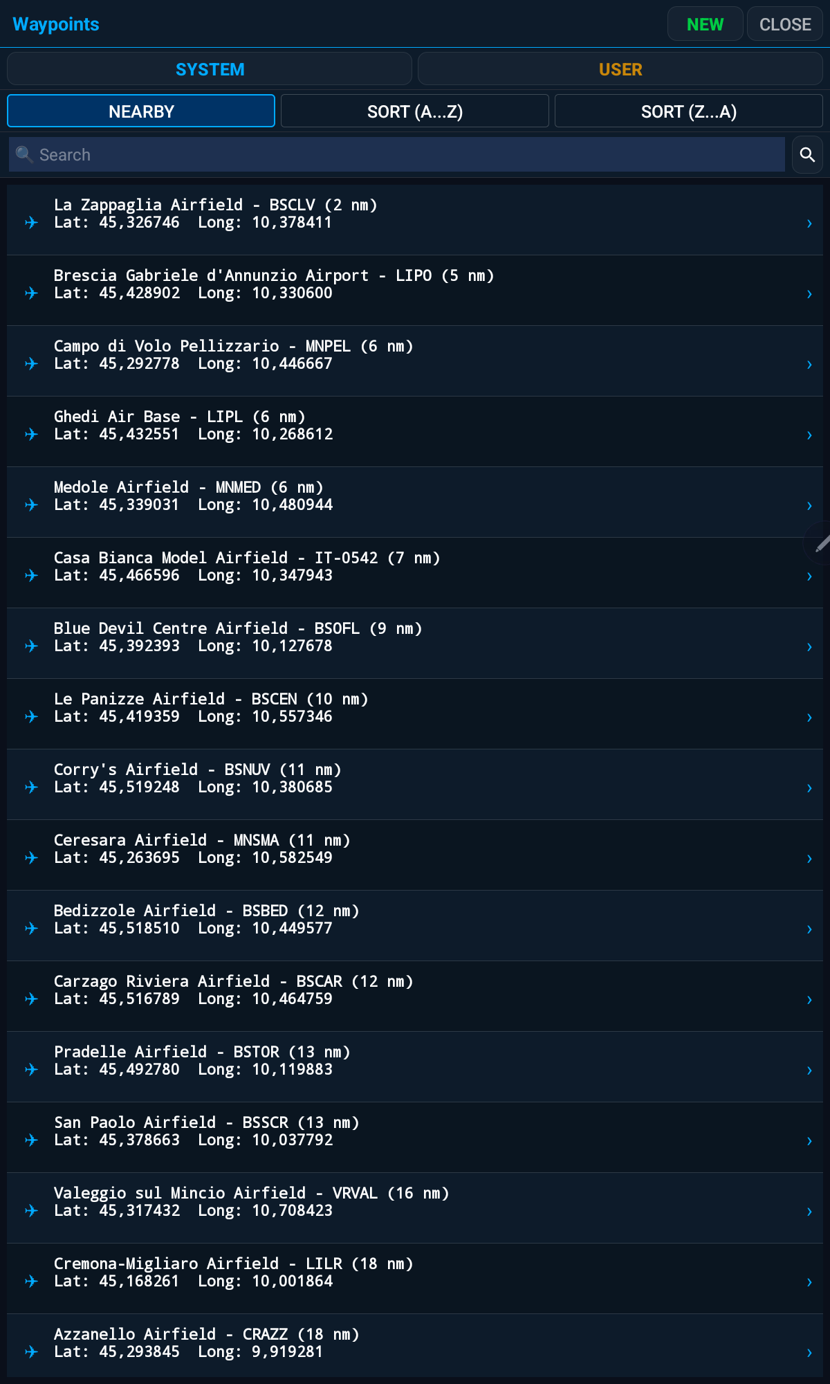
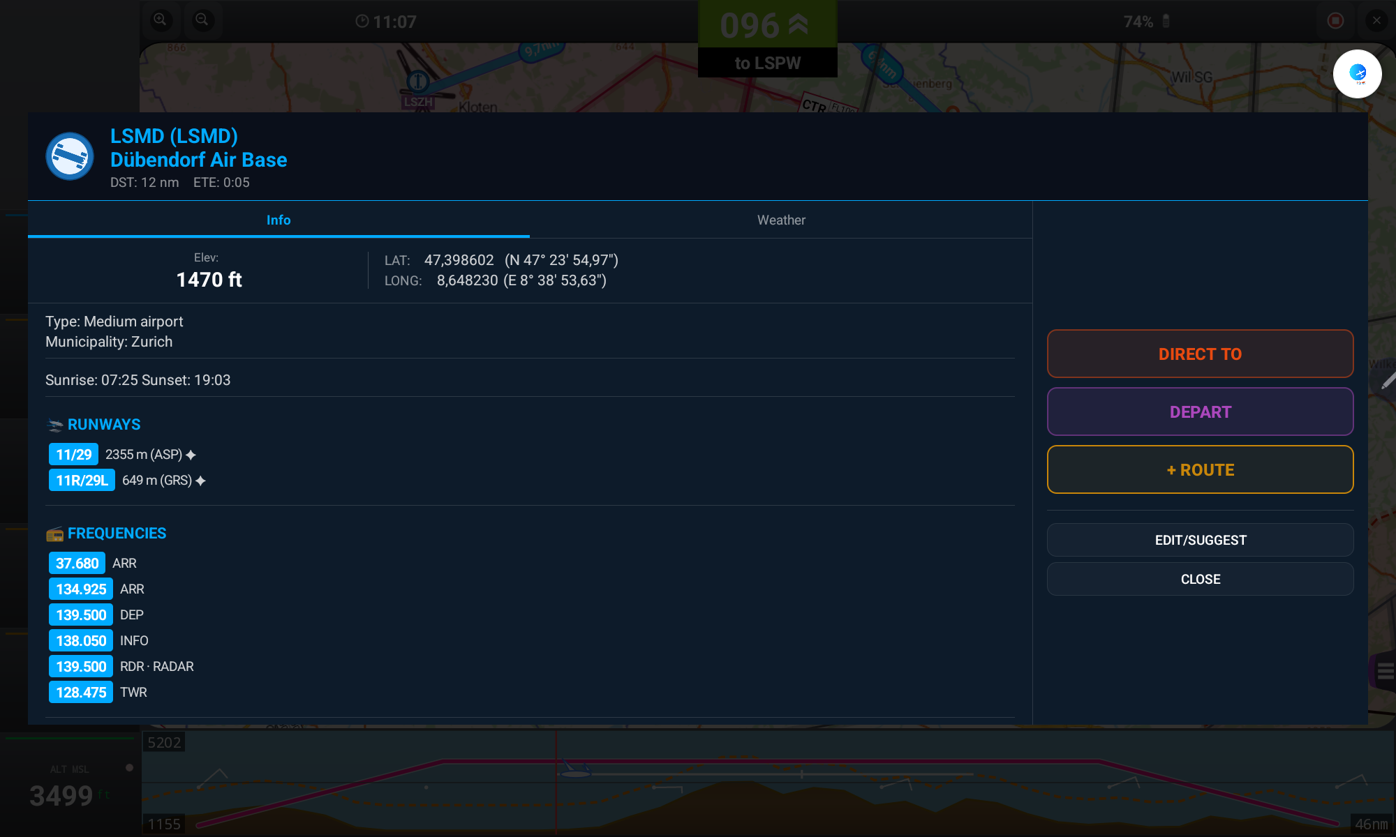
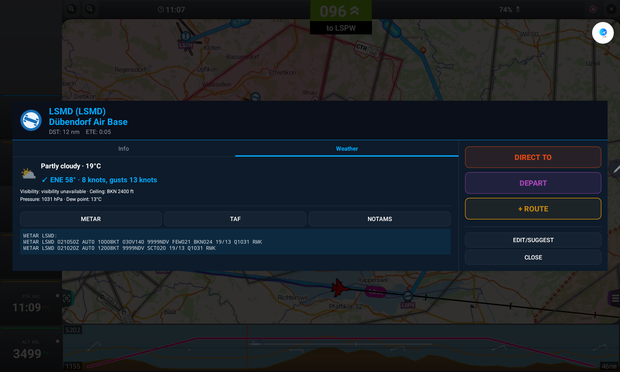
- From the waypoint info card, tap DIRECT TO to start a new route straight to it, or + ROUTE to add it as the next leg of the current route
- Tap DEPART to start a new route with that waypoint as the starting point, without including your current position (unlike DIRECT TO) — also available in the waypoints list, the route legs list, and the Fly To by coordinates and by bearing/distance dialogs
- Tap EDIT/SUGGEST to correct the waypoint's data
- Editing a System Waypoint turns it into a User Waypoint (the original stays available)
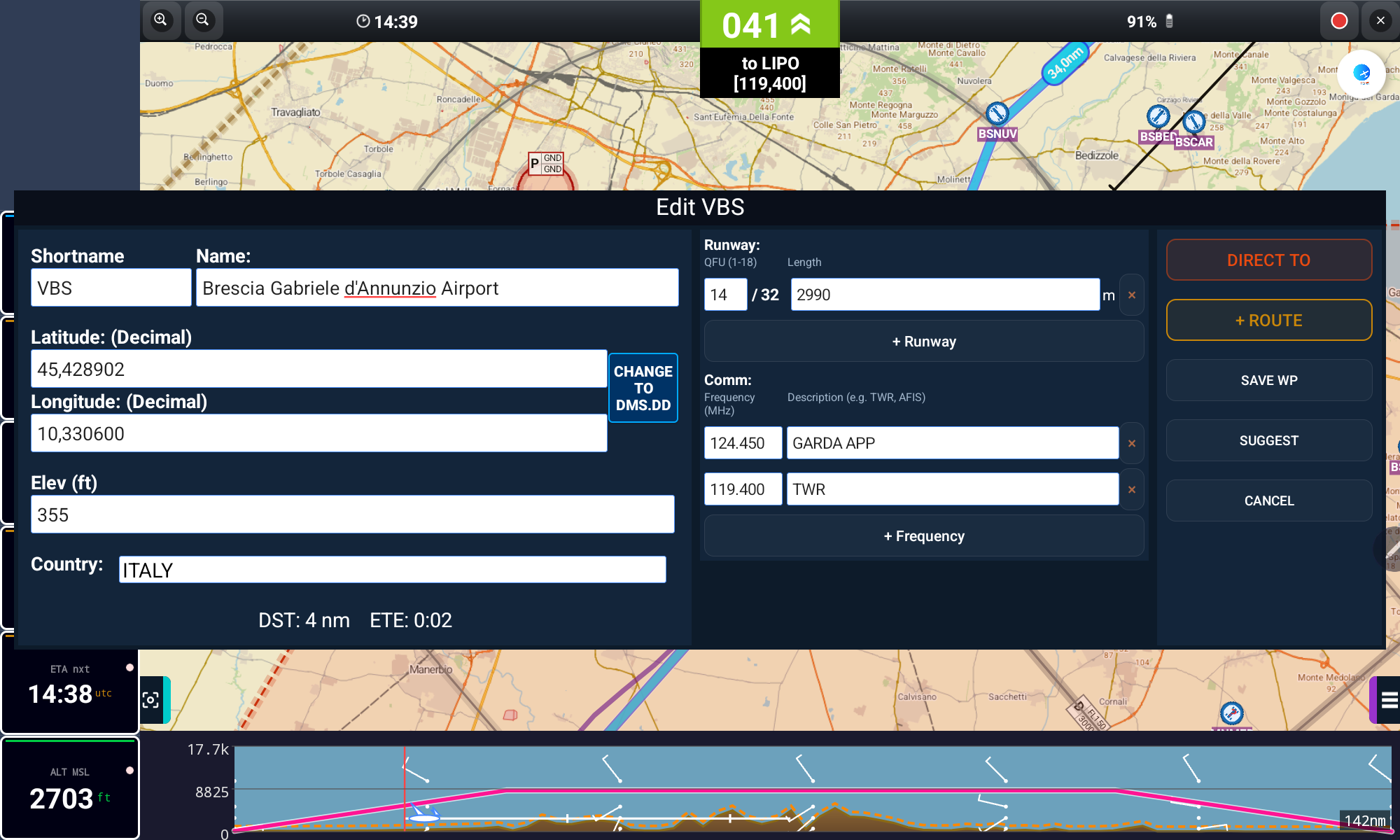
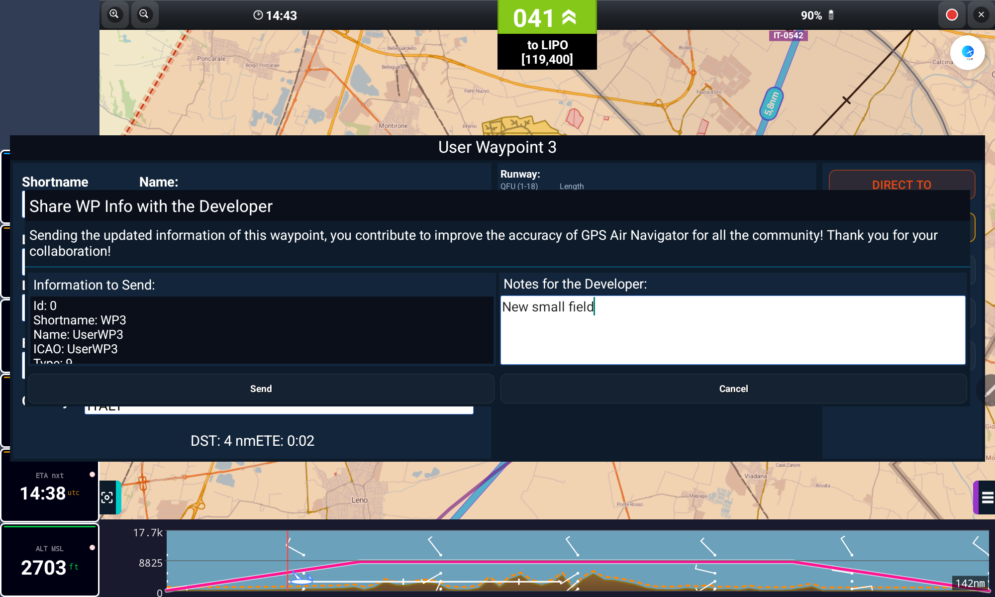
Long-pressing a row in the waypoints list (FLY TO → Waypoints) opens a quick menu with the same actions — Show Info, Direct To, Depart, + Route and Copy to Fly To Bearing — without opening the full card.
Long-pressing an empty spot on the map automatically opens the New User Waypoint window. If you don't actually want to save it as a User Waypoint and only need it as a route point, just tap DIRECT TO or + ROUTE there, without saving.
Plan Ahead
8. Routes & Flight Profile
Build a route with as many legs as you need, and let the app calculate ETE, distance and a full flight profile.
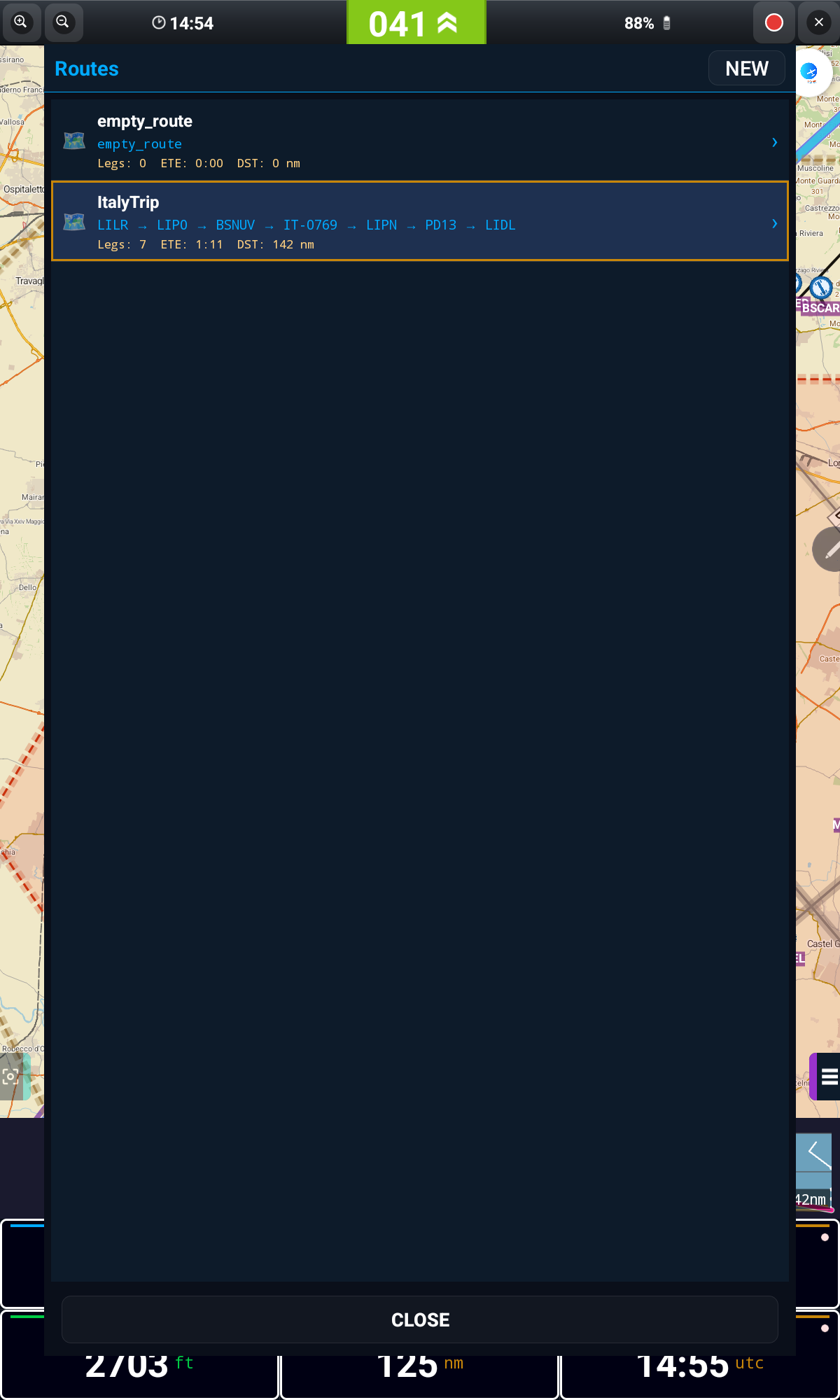
- Open FLY TO → Manage Routes and tap NEW, or add legs directly from any waypoint with + ROUTE
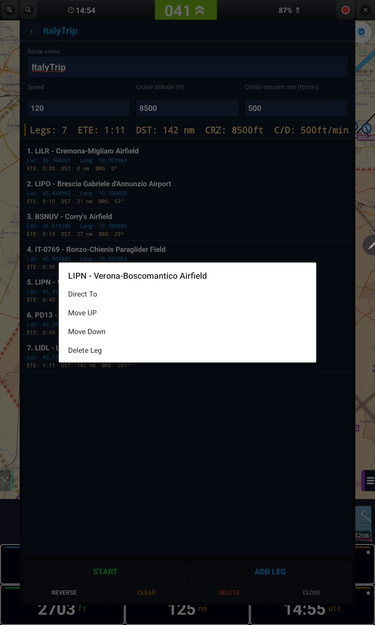
- Long-press a leg for Show Info, Direct To, Depart, Move Up, Move Down or Delete Leg
- Use REVERSE to fly the route backwards, or CLEAR to empty it
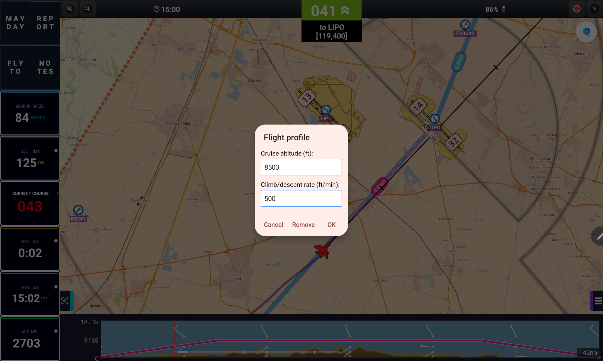
Define the route's speed, cruise altitude and climb/descent rate to get an accurate ETE and a realistic flight profile over the terrain.
Creating and moving route points directly on the map
- Long-press a segment of the route line (between two waypoints) and drag to create a new route point there — the route follows your finger in real time; lift to confirm
- These "loose" route points (with no aerodrome attached) are marked on the map with a red icon
- Long-press the red icon of an existing route point to drag it to another location, taking the route with it — drop it near a known waypoint/aerodrome to snap onto it automatically
Weather Ahead
9. GRAMET Weather Profile
GRAMET shows the forecast weather along your entire route as a vertical profile, aligned with the terrain and your planned altitude.
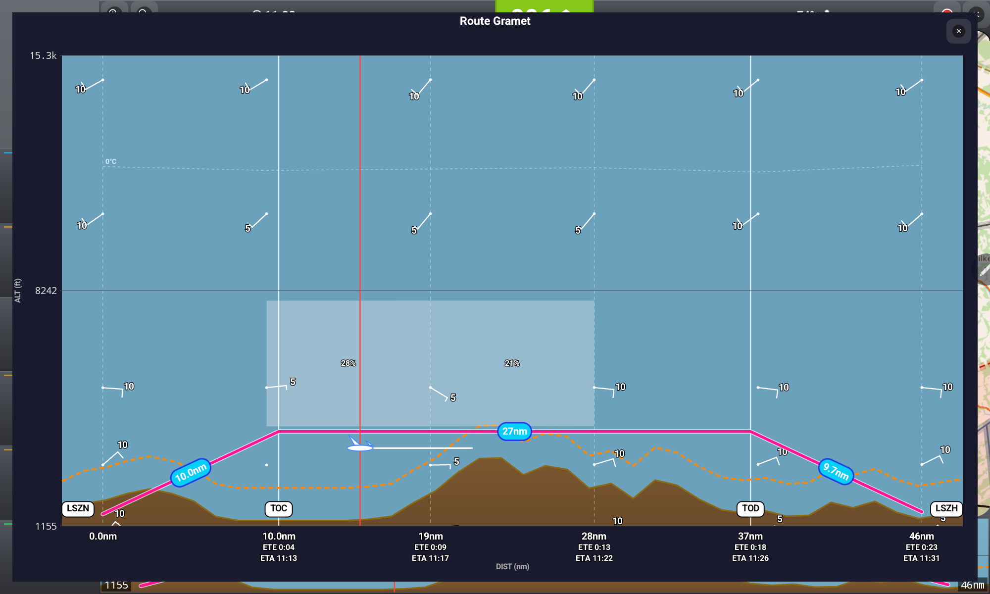
Tap the summarized terrain/weather strip at the bottom of the main screen (see Flight Data & Buttons) to open this detailed, full-screen GRAMET view. It is a great way to spot climbs, descents and possible weather hazards before departure.
Stay Clear
10. Airspace
Airspace information is shown directly over the map once you have downloaded it for your country.
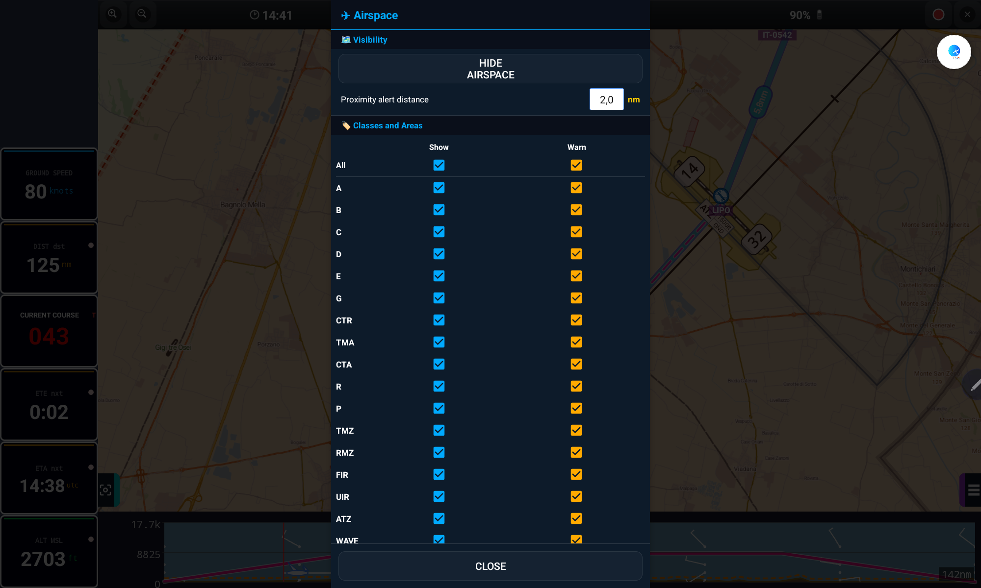
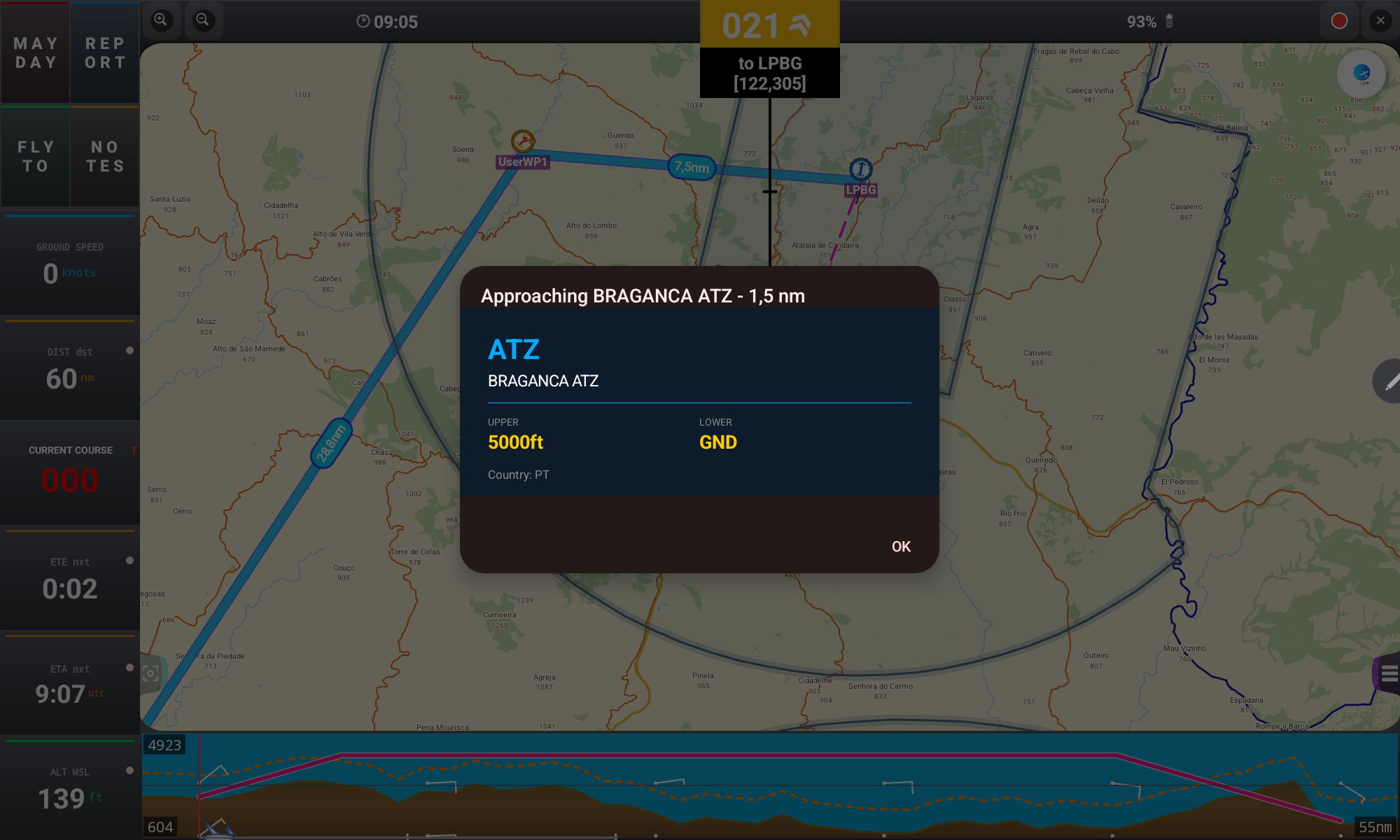
- Open the Airspace icon on the top bar
- Tick Show to display a class/area over the map, and Warn to be alerted when approaching it
- Set the Proximity alert distance (in nm) that triggers the warning
- Tap any airspace zone on the map to see its upper/lower limits and country
/sdcard/GPSAirNavigator/AirSpaces/Custom and selected as "Custom". Keep files under 1 MB to avoid slowing down the app.Map Overlays
11. Map Layers
Tap the LAYERS button on the main screen to quickly toggle everything drawn over the map.
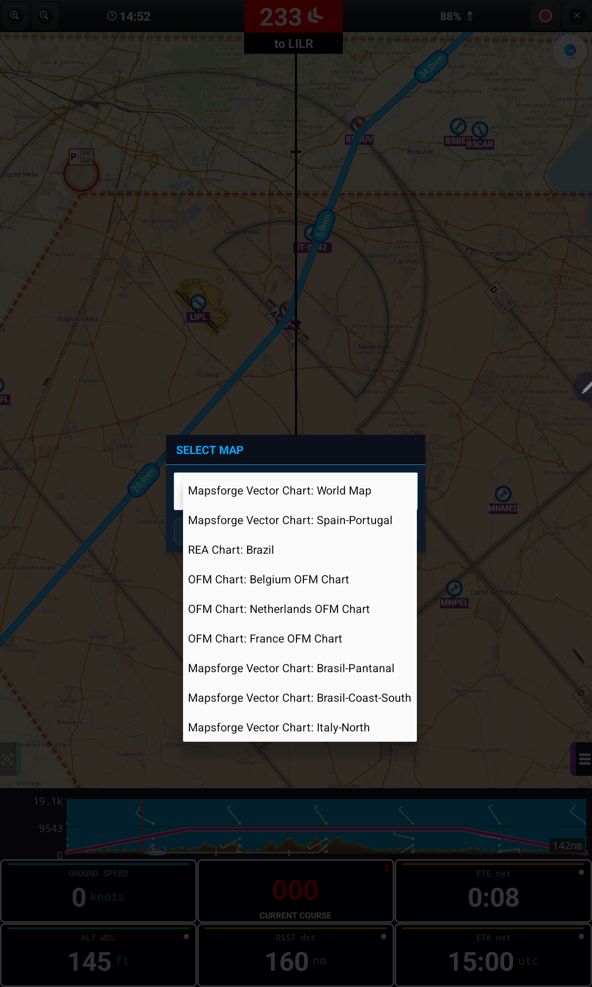
Use Map on the top bar to choose which downloaded chart is shown at any given time and location.
Talk to ATC
12. Position Report
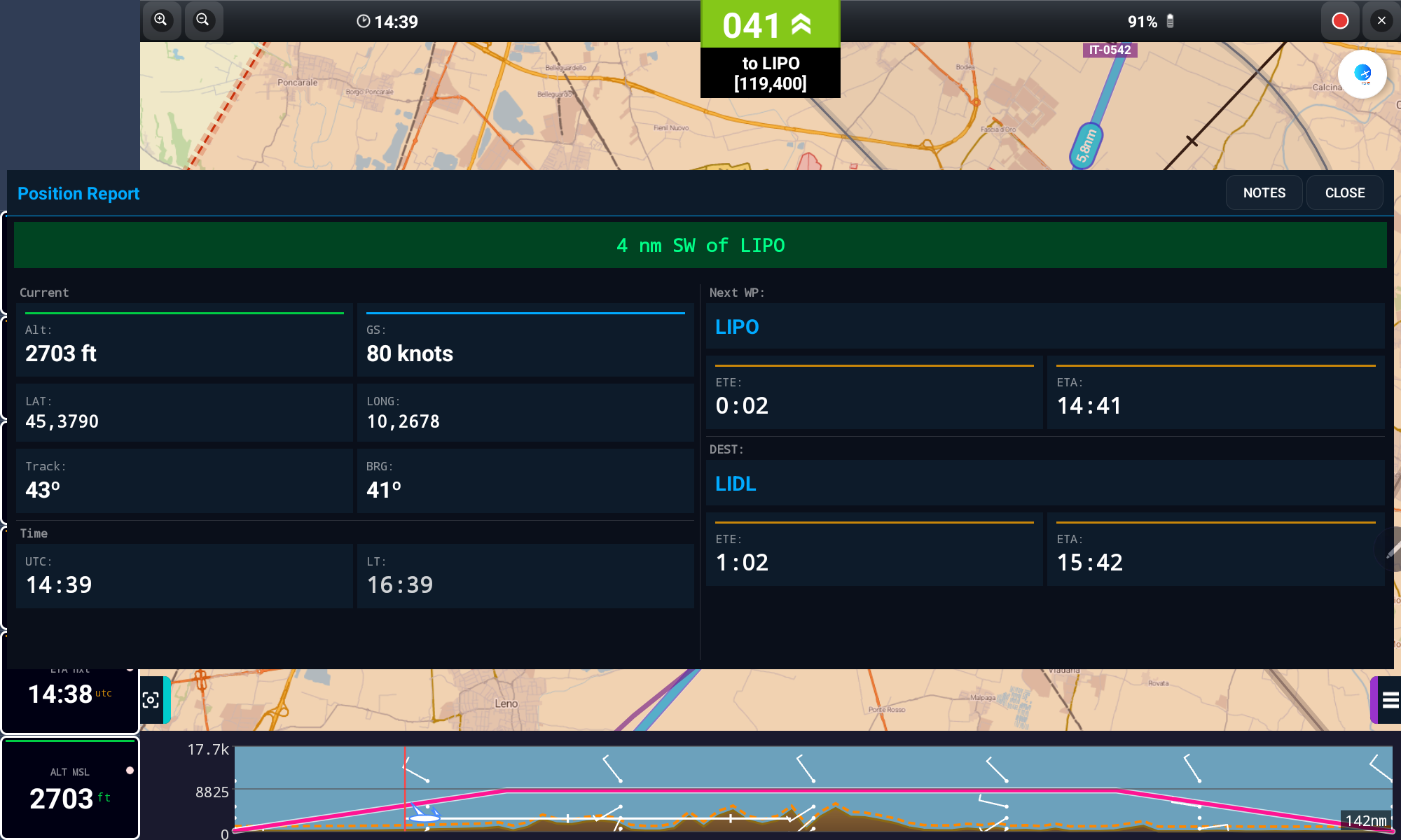
The REPORT button opens a clear summary of your current situation — perfect for reporting to ATC or a flight-following contact.
Emergency
13. MAYDAY
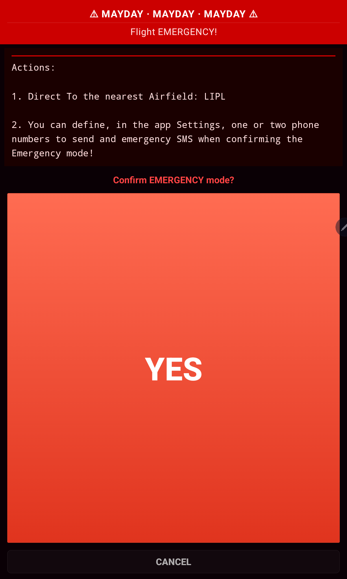
The MAYDAY button should be used only in a genuine flight emergency. Pressing it performs two actions after confirmation:
- Automatically sends an SMS with your current position to up to two mobile numbers set in Settings (requires mobile signal and an SMS-capable device)
- Activates a direct route to the nearest waypoint
Jot It Down
14. Notes
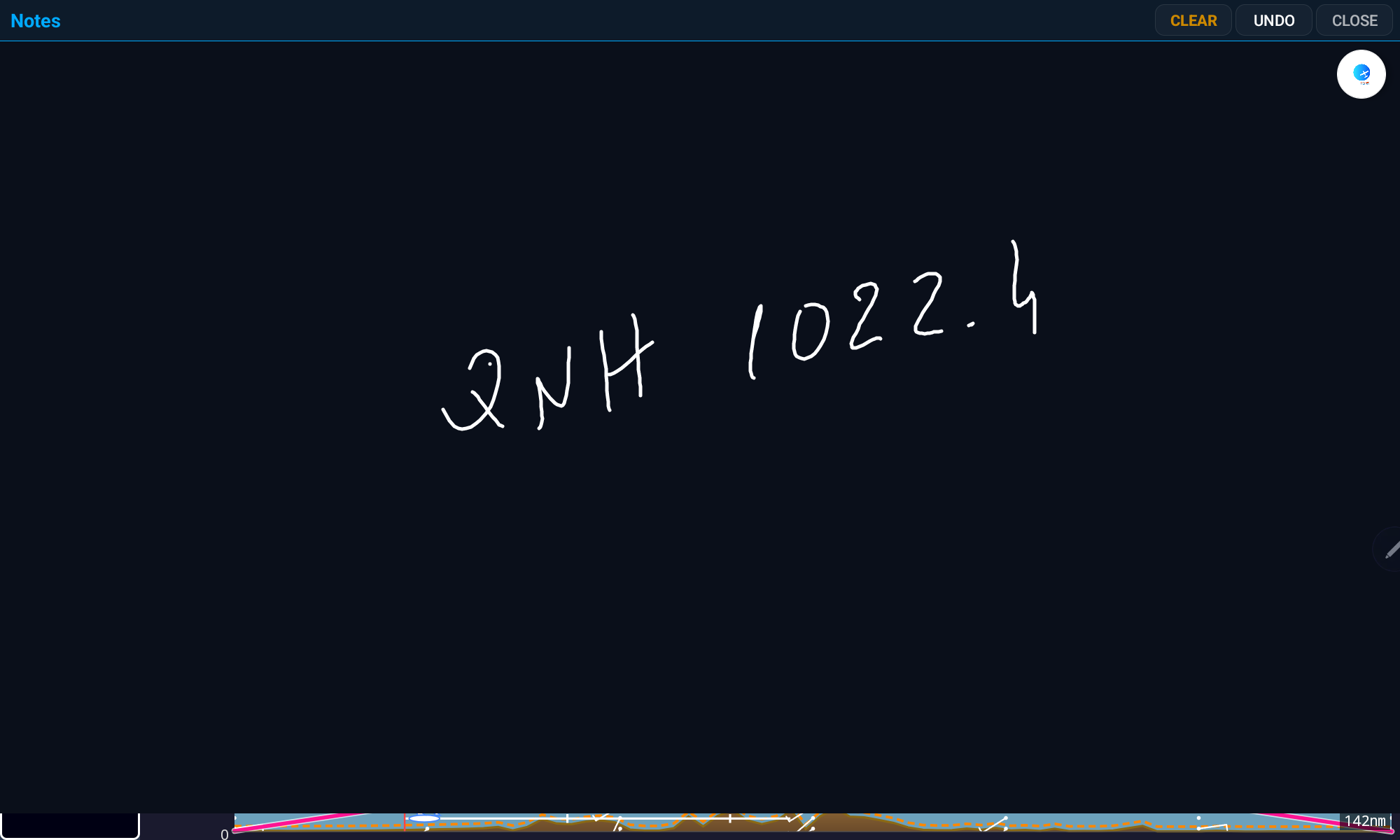
The NOTES button opens a simple black canvas where you can hand-write anything you need mid-flight — QNH, wind, frequencies, clearances.
Your Flight History
15. Logbook
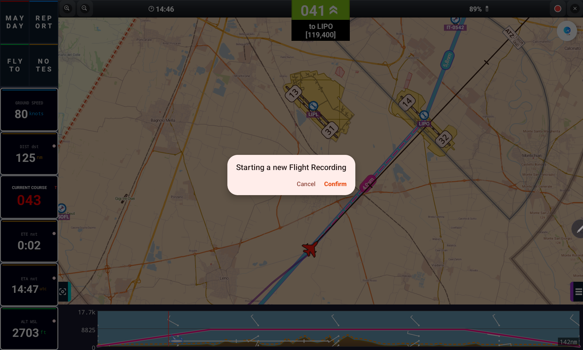
Every flight can be recorded automatically or started manually, then reviewed later with full statistics.
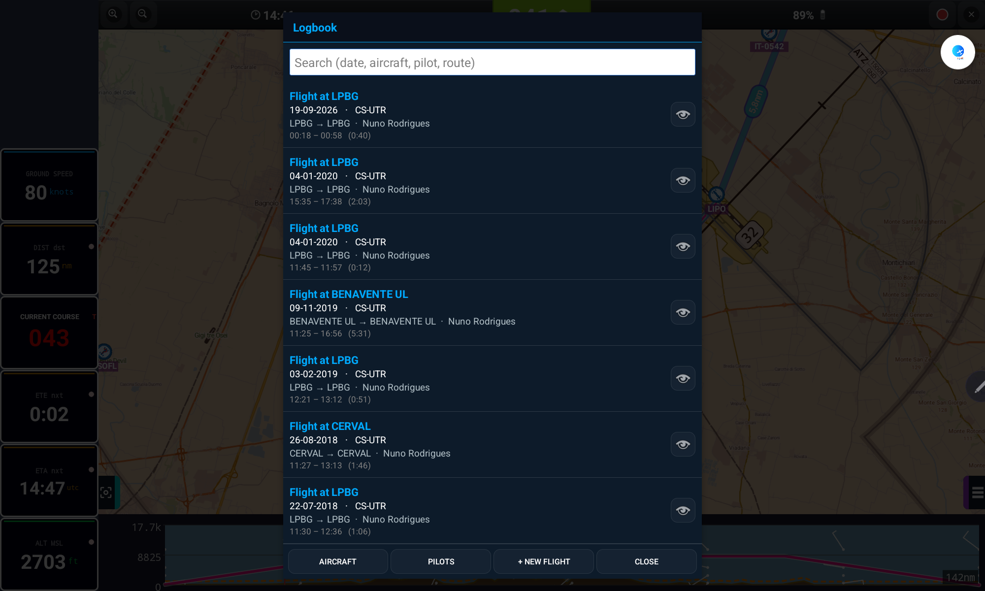
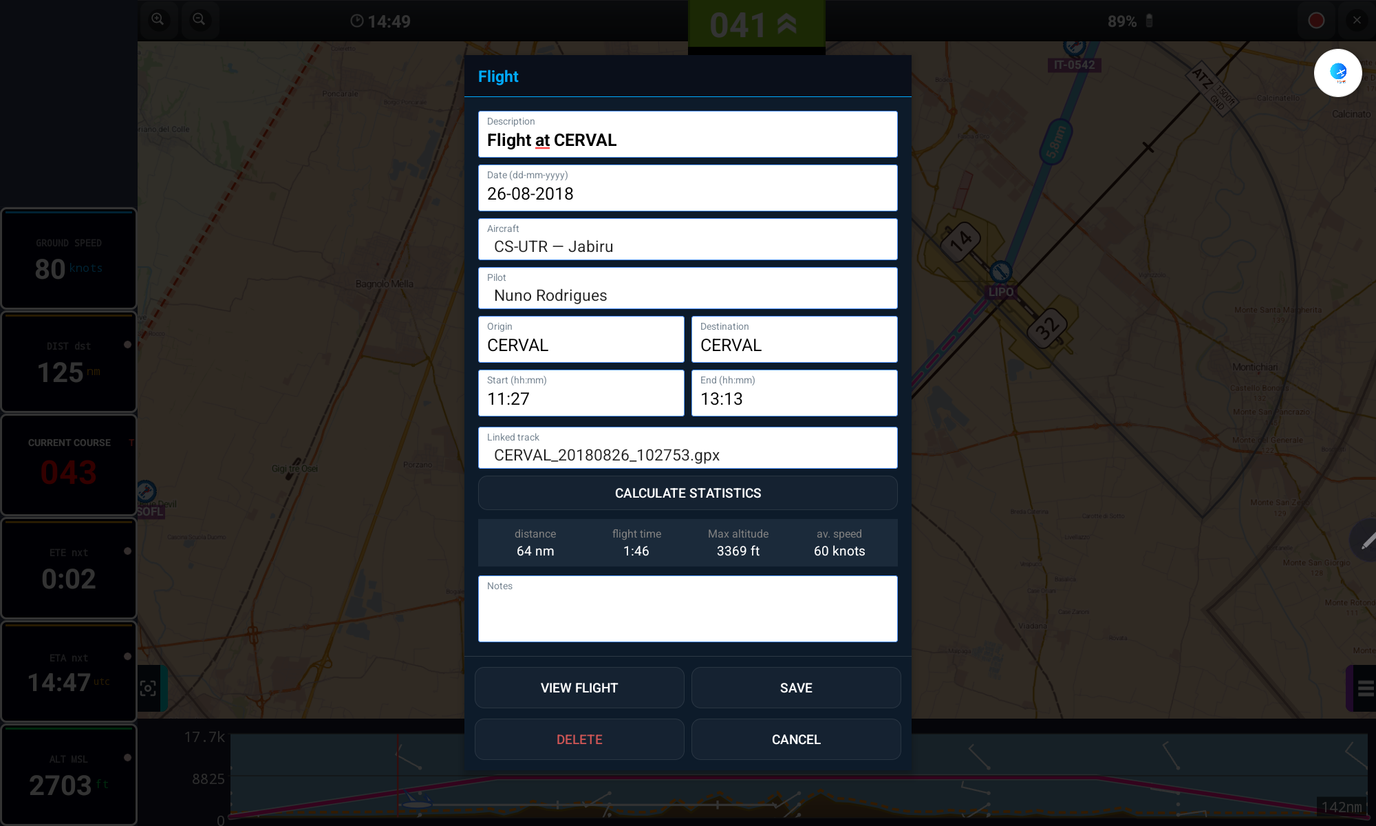
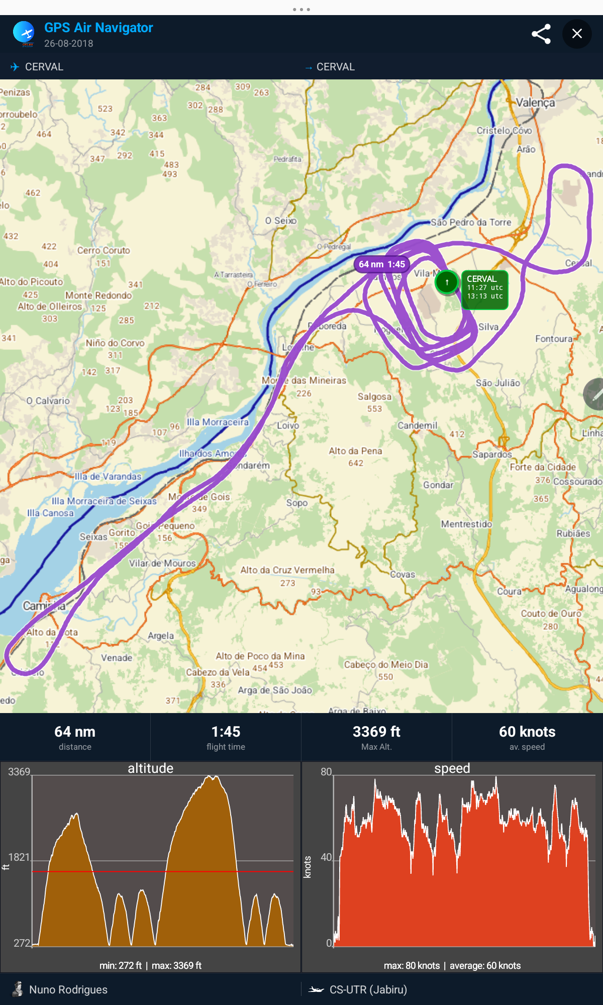
- Tap CALCULATE STATISTICS to get distance, flight time, max altitude and average speed
- Tap the share icon to export the flight as an image or send it by email / social media
- Manage Aircraft and Pilots from the Logbook screen buttons
Make It Yours
16. Settings
Fine-tune the app to your preferences and your aircraft.
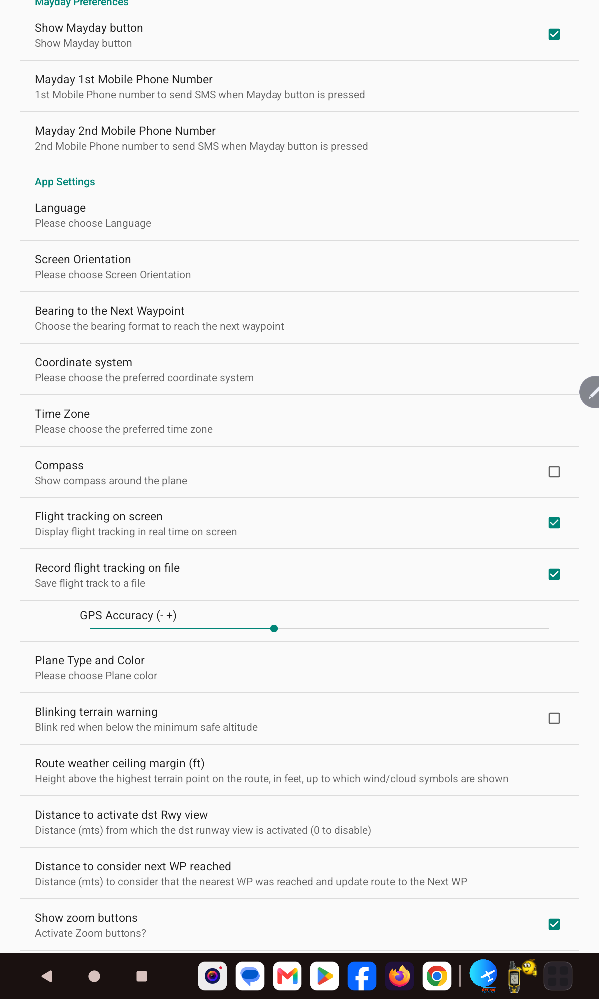
- MAYDAY phone numbers and button visibility
- Language, screen orientation, coordinate system and time zone
- Compass, flight tracking and GPS accuracy
- Plane color/type, terrain warning and units for every measurement
- Route weather ceiling margin and waypoint-arrival distance
Power Features
17. Advanced Features
Import / Export Waypoints
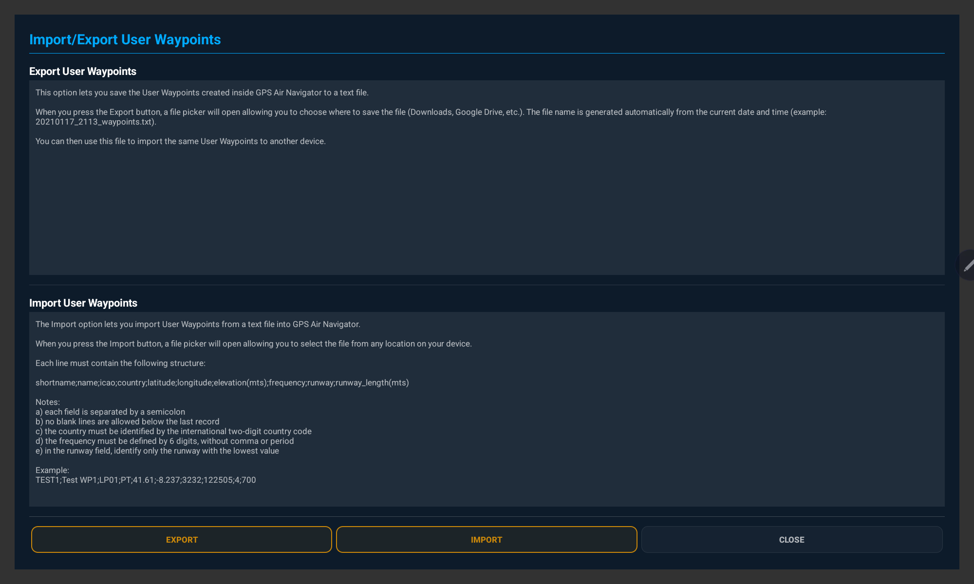
- Export saves all your User Waypoints to a text file you choose where to store
- Import reads a semicolon-separated text file back into the app
- Format:
shortname;name;icao;country;latitude;longitude;elevation(m);frequency;runway;runway_length(m)
Navigation with True or Magnetic North
Tap the Current Course value to switch between True (T) and Magnetic (M) North at any time; the default can also be set in Settings. Magnetic declination is calculated automatically from your position.